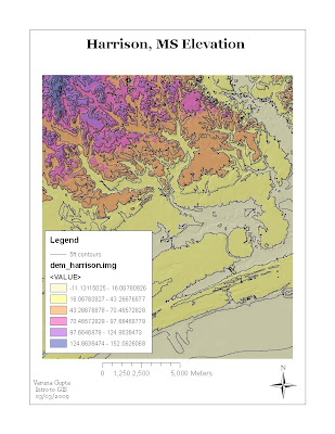
The above map is DEM with contour lines and hillshade. This exercise involved the manipuating of USGS 10 m DEM for study area ,Harrison. It used Spatial Analysis Extension.
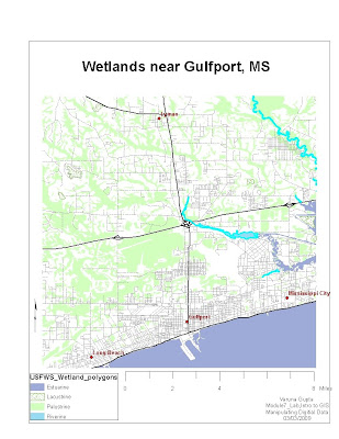
The map is the outcome of operations performed on the digital data obtained from the National wetland Inventory (NWI) developed by U.S Fish and Wildlife services. The map displays the wetlands and deepwaters habitats classification system. The exercise involved creating of new field in the attribute data, editing and reclass wetland system which is more easily interpreted.


